


 R$
R$  G$
G$ 


")
")
")
")
")
PARROT PROFESSIONAL BLUE GRASS (SEM BATERIA/CAIXA FEIA)
- Código: 285759
- Estoque: Disponível
-
$4.999,99
Não fazemos entregas fora do paraguai
Preços informados são em Dólares americanos, não incluem IVA e podem variar sem prévio aviso.
Linha de Brinquedos testados não possui Garantia.
Produtos em Promoção e Abaixo do Custo não possuem Troca nem Devolução.
NÃO CONTÉM BATERIA E CAIXA FEIA
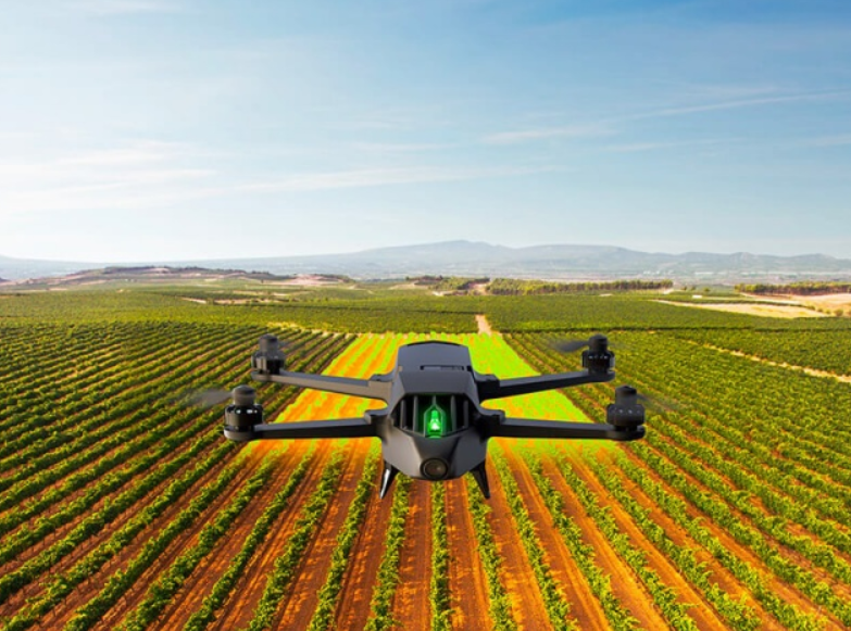
FIND OUT MORE ABOUT THE HEALTH OF YOUR CROPS
Parrot Bluegrass is equipped with a multispectral sensor, Parrot Sequoia. This small and light multispectral camera captures 4 spectral bands in visible light and non-visible infrared light to analyze the health of your crops. Parrot Sequoia has a 16 MP RGB camera and an internal memory capacity of 64GB.
Parrot Sequoia also comes with a sunshine sensor that records the current lighting conditions, the GPS location and inertial data.
Parrot Bluegrass Fields is a comprehensive, ready-to-fly drone solution that spans the entire crop analysis workflow. Parrot Bluegrass Fields provides agriculture professionals with the insights they need to maximize their yields and boost the quality of their crops.
- The rugged, easy-to-fly Parrot Bluegrass drone.
- The industry-leading Parrot Sequoia multispectral sensor and a 14 MP front RGB camera.
- ParrotFields mobile app to simplify the entire in-field workflow (one-year subscription).
- A full access to Pix4Dfields desktop and cloud software for further in-depth analysis of crop data gathered (one-year subscription).
MULTIPURPOSE DRONE FOR YOUR FARM
Designed to be easy to use and pilot, Parrot Bluegrass is a combination of an aerodynamic design, advanced autopilot, powerful engines and a high capacity battery.
Using Parrot Skycontroller 2 with Parrot Bluegrass you can execute very precise flights in a range of 2km (1.2 miles). The quadcopter transmits videos shot using its front camera to the controller, allowing you to inspect your farm, monitor your herds and get an overview of your land.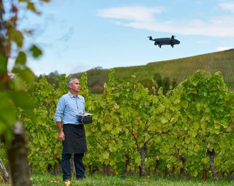
AUTOMATIC CROP MAPPING OF EACH PLOT USING PIX4DCAPTURE
The interface enables you to accurately define the area you want to fly over and at what altitude, so you can closely follow the status of your flight.
Parrot Bluegrass can cover up to 30 hectares at 70 m / 230 ft. flight altitude.
PIX4DCAPTURE: FLIGHT PLANNING MOBILE APP
Pix4Dcapture is a mobile flight planning app to optimize mapping data from your consumer drone. This free app created by Pix4D software lets you select a flight plan and capture image data, ready to create georeferenced maps and models in Pix4D desktop software. Available for Android and iOS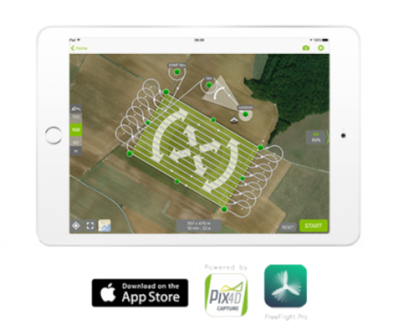
INSPECTION AND ANALYSIS OF CROPS
Analyzing crops and orchards from the sky to evaluate and optimize their health Professional Parrot solutions make life easier for farmers by enabling them to carry out aerial surveillance work on their vineyards, fruit trees, berries, rapeseed and grain crops. The data collected during the drone’s flight provides radiography of unprecedented precision to identify the needs of each plot of land: NDVI maps and zonings. No knowledge of flying drones is required.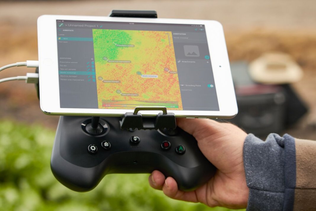
OVERVIEW :
- Range: Up to 2km – 1.2 miles, in an unobstructed area free of interferences
- Ground resolution: 6.6cm/px (2.7in/px) at 70m (230ft) flight altitude
- Automatic flight plan powered by Pix4Dcapture mobile app
- Vertical take-off and landing
- Area Coverage: 30ha (74ac) in a single flight at 70m flight altitude (230ft)
GENERAL :
- Weight: 1850g / 4lb
- Size: 50 x 44 x 12 cm / 20 x 17 x 5 in.
- Removable propellers for transport
PHOTO & VIDEO :
- Photo: 14MP wide angle camera
- Video: 1080p Full HD
- Video streaming: 360p / 720p
- Internal Video Memory: 32GB
WI-FI AND TRANSMISSIONS :
- Range: Up to 2km with Parrot Skycontroller 2, in an unobstructed area free of interferences
- Wi-Fi AC-type, 2 bi-band antennas (2,4 and 5GHz)
HIGH CAPACITY BATTERY :
- Battery life : 25min
- 6700 mAh Lipo Battery
SENSORS :
- Built-in GPS + GLONASS
- Inertial Navigation System
- Altimeter
- Ultrasonic sensor
- Optical flow vertical camera
PARROT SEQUOIA
CAMÉRA RVB :
- Resolution : 16 Mpx, 4608 x 3456 pixels
- HFOV : 63.9°
- VFOV : 50.1°
- DFOV : 73.5°
4 GLOBAL SHUTTER SINGLE-BAND CAMERAS :
- Resolution: 1.2 Mpx, 1280×960 pixels
- HFOV: 61.9°
- VFOV: 48.5°
- DFOV: 73.7°
4 SEPARATE BANDS :
- Green (550 nm +/- 40 nm)
- Red (660 nm +/- 40 nm)
- Red-edge (735 nm +/-10 nm)
- Proche infrarouge (790 nm +/-40 nm)
GENERAL :
- Dimensions : 59 x 41 x 28 mm (2.3×1.6×1.1in)
- Weight: 72 g / 0.15 lb.
- Photo mode: Up to 1 fps
- Internal storage: 64 GB built-in storage
- Inertial measurement unit & magnetometer
- Power: 5 W (~12 W peak)
SUNSHINE SENSOR (INCL. IN PARROT SEQUOIA) :
- Dimensions: 47×39.6×18.5mm (1.8×1.5×0.7in)
- Weight: 35 g (0.07 lb)
- 4 spectral sensors (same filters as body)
- GPS
- Inertial measurement unit & magnetometer
- SD Card slot
- Power: 1 W
FEATURES :
- Up to 150 ha / 370 acres processed per week at 120m flight altitude
- Unlimited surface for the first processing
- AIRINOV reports includes:
- Absolute NDVI map: index value from -1 to 1
- Adjusted NDVI map
- Simple zoning map: NDVI map divided in 3 zones
- Detailed zoning map: NDVI map divided in 7 zones